
File:Bridleway to the Pigeon Tower - geograph.org.uk - 572342.jpg
No higher resolution available.
Bridleway_to_the_Pigeon_Tower_-_geograph.org.uk_-_572342.jpg (640 × 480 pixels, file size: 131 KB, MIME type: image/jpeg)
| This is a file from the Wikimedia Commons. Information from its description page there is shown below. Commons is a freely licensed media file repository. You can help. |
Summary
| Description |
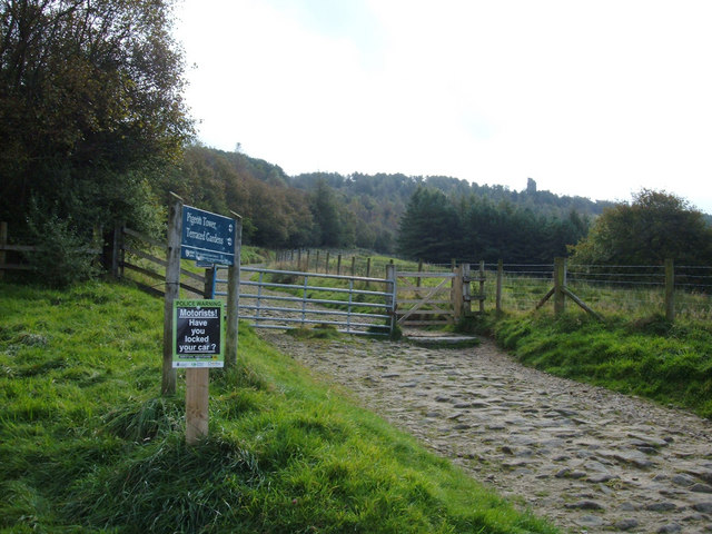
English: Roynton Road (USRN: 7400820) to Rivington and Blackrod High School. Here we are near the Sheep House Lane car park looking towards the Pigeon Tower on the skyline. En-route to the tower one passes the seven-arch bridge, ruin of Stone House lodge and remains of Kitchen and Japanese Gardens. This is an open public road recorded on the National Street Gazetteer. [1] |
| Date | |
| Source | From geograph.org.uk |
| Author | michael ely |
| Attribution (required by the license) | michael ely / Bridleway to the Pigeon Tower / |
| Camera location | | View this and other nearby images on: OpenStreetMap |
|---|
_heading:157.00&language=en)
| Object location | | View this and other nearby images on: OpenStreetMap |
|---|
_heading:157.00&language=en)
Licensing

|
This image was taken from the Geograph project collection. See this photograph's page on the Geograph website for the photographer's contact details. The copyright on this image is owned by michael ely and is licensed for reuse under the Creative Commons Attribution-ShareAlike 2.0 license.
|
This file is licensed under the Creative Commons Attribution-Share Alike 2.0 Generic license.
Attribution: michael ely
- You are free:
- to share – to copy, distribute and transmit the work
- to remix – to adapt the work
- Under the following conditions:
- attribution – You must give appropriate credit, provide a link to the license, and indicate if changes were made. You may do so in any reasonable manner, but not in any way that suggests the licensor endorses you or your use.
- share alike – If you remix, transform, or build upon the material, you must distribute your contributions under the same or compatible license as the original.
- ↑ National Street Gazetteer. Find My Street. findmystreet.co.uk. Retrieved on 9 September 2019.
File history
Click on a date/time to view the file as it appeared at that time.
| Date/Time | Thumbnail | Dimensions | User | Comment | |
|---|---|---|---|---|---|
| current | 09:32, 6 February 2011 | | 640 × 480 (131 KB) | GeographBot | == {{int:filedesc}} == {{Information |description={{en|1=Bridleway to the Pigeon Tower One of the many bridleways in the Lever Park/Rivington area that makes it a mecca for walking and mountain biking. Here we are near the top car park looking towards the |
File usage
The following pages on the English Wikipedia use this file (pages on other projects are not listed):