
File:Nautical chart of Mediterranean area, including Europe with British Isles and part of Scandinavia.jpg

Size of this preview: 800 × 587 pixels. Other resolutions: 320 × 235 pixels | 640 × 470 pixels | 1,024 × 752 pixels | 1,280 × 940 pixels | 2,560 × 1,880 pixels | 9,410 × 6,909 pixels.
Original file (9,410 × 6,909 pixels, file size: 18 MB, MIME type: image/jpeg)
| This is a file from the Wikimedia Commons. Information from its description page there is shown below. Commons is a freely licensed media file repository. You can help. |
| Warning | The original file is very high-resolution. It might not load properly or could cause your browser to freeze when opened at full size. |
|---|
Summary
| Description |
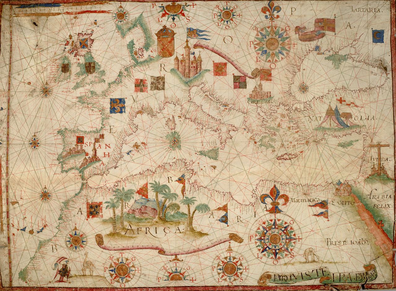
English: Nautical chart of Mediterranean area, including Europe with British Isles and part of Scandinavia.
Call Number: HM 1549 The map shows shields or heraldic banners of a number of realms, including:
|
| Date | circa 1600 |
| Source | berkeley.edu |
| Author | Unknown author |
| Other versions |
|


Source:
Licensing
|
This is a faithful photographic reproduction of a two-dimensional, public domain work of art. The work of art itself is in the public domain for the following reason:
The official position taken by the Wikimedia Foundation is that "faithful reproductions of two-dimensional public domain works of art are public domain".
This photographic reproduction is therefore also considered to be in the public domain in the United States. In other jurisdictions, re-use of this content may be restricted; see Reuse of PD-Art photographs for details. | ||||
File history
Click on a date/time to view the file as it appeared at that time.
| Date/Time | Thumbnail | Dimensions | User | Comment | |
|---|---|---|---|---|---|
| current | 07:22, 1 January 2011 | | 9,410 × 6,909 (18 MB) | Geagea | test |
| 07:30, 25 December 2010 |  | 5,792 × 3,672 (6.33 MB) | AnonMoos | Reverted to version as of 12:06, 24 December 2010 -- other version definitely not working | |
| 04:55, 25 December 2010 | No thumbnail | 0 × 0 (29.52 MB) | Geagea | Reverted to version as of 04:47, 25 December 2010 | |
| 12:06, 24 December 2010 |  | 5,792 × 3,672 (6.33 MB) | AnonMoos | losslessly cropping | |
| 02:03, 24 December 2010 |  | 5,948 × 4,131 (6.66 MB) | Geagea | == {{int:filedesc}} == {{Information |Description={{en|1=Nautical chart of Mediterranean area, including Europe with British Isles and part of Scandinavia. Call Number: HM 1549}} |Source=[http://digitalassets.lib.berkeley.edu/ds/huntington/images//000561B |
File usage
The following pages on the English Wikipedia use this file (pages on other projects are not listed):
Global file usage
The following other wikis use this file:
- Usage on es.wikipedia.org
- Usage on eu.wikipedia.org
- Usage on fr.wikipedia.org