
File:Nottinghamshire district numbered.svg

Size of this PNG preview of this SVG file: 340 × 598 pixels. Other resolutions: 136 × 240 pixels | 273 × 480 pixels | 436 × 768 pixels | 582 × 1,024 pixels | 1,163 × 2,048 pixels | 354 × 623 pixels.
Original file (SVG file, nominally 354 × 623 pixels, file size: 33 KB)
| This is a file from the Wikimedia Commons. Information from its description page there is shown below. Commons is a freely licensed media file repository. You can help. |
Summary
| Description |
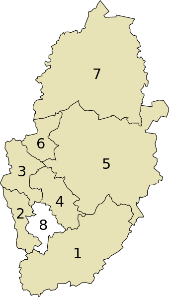
English: Nottinghamshire districts map (numbered)
For use on the w:Nottinghamshire Wikipedia page. |
| Date | |
| Source | Own work |
| Author | Mirrorme22 |
Licensing
| I, the copyright holder of this work, release this work into the public domain. This applies worldwide. In some countries this may not be legally possible; if so: I grant anyone the right to use this work for any purpose, without any conditions, unless such conditions are required by law. |
File history
Click on a date/time to view the file as it appeared at that time.
| Date/Time | Thumbnail | Dimensions | User | Comment | |
|---|---|---|---|---|---|
| current | 14:36, 12 March 2011 | | 354 × 623 (33 KB) | Mirrorme22 | new colour scheme & smaller font. |
| 12:28, 22 September 2010 |  | 354 × 623 (32 KB) | Mirrorme22 | {{Information |Description={{en|1=Nottinghamshire districts map (numbered) For use on the w:Nottinghamshire Wikipedia page.}} |Source={{own}} |Author=Mirrorme22 |Date=2010-09-22 |Permission= |other_versions= }} Category:Maps |
File usage
The following pages on the English Wikipedia use this file (pages on other projects are not listed):
Global file usage
The following other wikis use this file:
- Usage on af.wikipedia.org
- Usage on arz.wikipedia.org
- Usage on cy.wikipedia.org
- Usage on da.wikipedia.org
- Usage on et.wikipedia.org
- Usage on fa.wikipedia.org
- Usage on gv.wikipedia.org
- Usage on hu.wikipedia.org
- Usage on tr.wikipedia.org
- Usage on ur.wikipedia.org